


Lou Cami del Payraire

CANON2
User
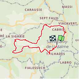

Length
17.1 km

Max alt
698 m

Uphill gradient
450 m
Km-Effort
23 km

Min alt
472 m

Downhill gradient
452 m
Boucle
Yes
Creation date :
2019-05-15 13:09:12.561
Updated on :
2019-05-15 13:09:12.657
4h54
Difficulty : Medium

FREE GPS app for hiking
 SityTrail
IGN / Geographical institutes
SityTrail Plus
The world is yours!
About
Trail Walking of 17.1 km to be discovered at Occitania, Tarn, Saint-Salvy-de-la-Balme. This trail is proposed by CANON2.
Description
Belle randonée dans le site Sidobrien avec Histoire des tailleurs de pierre!
Positioning
Country:
France
Region :
Occitania
Department/Province :
Tarn
Municipality :
Saint-Salvy-de-la-Balme
Location:
Unknown
Start:(Dec)
Start:(UTM)
451495 ; 4828869 (31T) N.
Comments
merci, Audier.