


Cieurac Pauliac

antignacs
User GUIDE
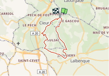

Length
12 km

Max alt
282 m

Uphill gradient
168 m
Km-Effort
14.3 km

Min alt
199 m

Downhill gradient
161 m
Boucle
Yes
Creation date :
2022-01-02 13:37:04.0
Updated on :
2022-01-02 16:07:02.31
2h29
Difficulty : Very easy

FREE GPS app for hiking
 SityTrail
IGN / Geographical institutes
SityTrail Plus
The world is yours!
About
Trail Walking of 12 km to be discovered at Occitania, Lot, Cieurac. This trail is proposed by antignacs.
Photos


Positioning
Country:
France
Region :
Occitania
Department/Province :
Lot
Municipality :
Cieurac
Location:
Unknown
Start:(Dec)
Start:(UTM)
382459 ; 4914263 (31T) N.
Comments