


7 km | 8.7 km-effort

User


FREE GPS app for hiking
 SityTrail
IGN / Geographical institutes
SityTrail World
The world is yours!
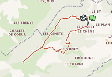
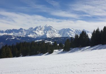
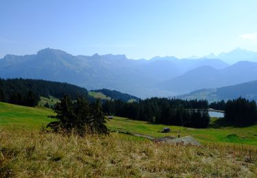
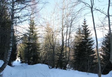
Trail Snowshoes of 9.9 km to be discovered at Auvergne-Rhône-Alpes, Upper Savoy, Cordon. This trail is proposed by djeepee74.
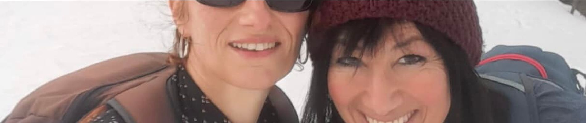
BOUCLE... live de Cris et Karine le 20220103
... montée: par les chalets des Bénés _ descente: boucle par la Croix du Planet.
Rando raquettes très physique.
 "
data-pinterest-text="Pin it"
data-tweet-text="share on twitter"
data-facebook-share-url="https://www.sitytrail.com/en/trails/3040593-cordon--aravisx-cabane-du-petit-patre-au-depart-de-xle-perayx/?photo=1#lg=1&slide=1"
data-twitter-share-url="https://www.sitytrail.com/en/trails/3040593-cordon--aravisx-cabane-du-petit-patre-au-depart-de-xle-perayx/?photo=1#lg=1&slide=1"
data-googleplus-share-url="https://www.sitytrail.com/en/trails/3040593-cordon--aravisx-cabane-du-petit-patre-au-depart-de-xle-perayx/?photo=1#lg=1&slide=1"
data-pinterest-share-url="https://www.sitytrail.com/en/trails/3040593-cordon--aravisx-cabane-du-petit-patre-au-depart-de-xle-perayx/?photo=1#lg=1&slide=1">
"
data-pinterest-text="Pin it"
data-tweet-text="share on twitter"
data-facebook-share-url="https://www.sitytrail.com/en/trails/3040593-cordon--aravisx-cabane-du-petit-patre-au-depart-de-xle-perayx/?photo=1#lg=1&slide=1"
data-twitter-share-url="https://www.sitytrail.com/en/trails/3040593-cordon--aravisx-cabane-du-petit-patre-au-depart-de-xle-perayx/?photo=1#lg=1&slide=1"
data-googleplus-share-url="https://www.sitytrail.com/en/trails/3040593-cordon--aravisx-cabane-du-petit-patre-au-depart-de-xle-perayx/?photo=1#lg=1&slide=1"
data-pinterest-share-url="https://www.sitytrail.com/en/trails/3040593-cordon--aravisx-cabane-du-petit-patre-au-depart-de-xle-perayx/?photo=1#lg=1&slide=1">
 "
data-pinterest-text="Pin it"
data-tweet-text="share on twitter"
data-facebook-share-url="https://www.sitytrail.com/en/trails/3040593-cordon--aravisx-cabane-du-petit-patre-au-depart-de-xle-perayx/?photo=2#lg=1&slide=2"
data-twitter-share-url="https://www.sitytrail.com/en/trails/3040593-cordon--aravisx-cabane-du-petit-patre-au-depart-de-xle-perayx/?photo=2#lg=1&slide=2"
data-googleplus-share-url="https://www.sitytrail.com/en/trails/3040593-cordon--aravisx-cabane-du-petit-patre-au-depart-de-xle-perayx/?photo=2#lg=1&slide=2"
data-pinterest-share-url="https://www.sitytrail.com/en/trails/3040593-cordon--aravisx-cabane-du-petit-patre-au-depart-de-xle-perayx/?photo=2#lg=1&slide=2">
"
data-pinterest-text="Pin it"
data-tweet-text="share on twitter"
data-facebook-share-url="https://www.sitytrail.com/en/trails/3040593-cordon--aravisx-cabane-du-petit-patre-au-depart-de-xle-perayx/?photo=2#lg=1&slide=2"
data-twitter-share-url="https://www.sitytrail.com/en/trails/3040593-cordon--aravisx-cabane-du-petit-patre-au-depart-de-xle-perayx/?photo=2#lg=1&slide=2"
data-googleplus-share-url="https://www.sitytrail.com/en/trails/3040593-cordon--aravisx-cabane-du-petit-patre-au-depart-de-xle-perayx/?photo=2#lg=1&slide=2"
data-pinterest-share-url="https://www.sitytrail.com/en/trails/3040593-cordon--aravisx-cabane-du-petit-patre-au-depart-de-xle-perayx/?photo=2#lg=1&slide=2">

Walking

Walking

Snowshoes
Snowshoes
Touring skiing
On foot
On foot
Walking

Mountain bike