


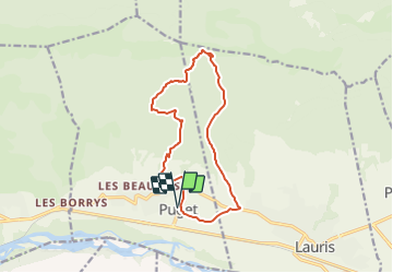
puget_aigle

Nathy8913
User

Length
13.9 km

Max alt
617 m

Uphill gradient
560 m
Km-Effort
21 km

Min alt
157 m

Downhill gradient
561 m
Boucle
Yes
Creation date :
2022-01-03 16:09:36.306
Updated on :
2022-01-03 16:11:13.167
4h51
Difficulty : Medium

FREE GPS app for hiking
 SityTrail
IGN / Geographical institutes
SityTrail Plus
The world is yours!
About
Trail Walking of 13.9 km to be discovered at Provence-Alpes-Côte d'Azur, Vaucluse, Puget. This trail is proposed by Nathy8913.
Positioning
Country:
France
Region :
Provence-Alpes-Côte d'Azur
Department/Province :
Vaucluse
Municipality :
Puget
Location:
Unknown
Start:(Dec)
Start:(UTM)
682732 ; 4847226 (31T) N.
Comments