


Tour du Queyras - Etape 1

CLP01
User

Length
7.7 km

Max alt
2497 m

Uphill gradient
939 m
Km-Effort
17.8 km

Min alt
1552 m

Downhill gradient
213 m
Boucle
No
Creation date :
2022-01-03 18:58:29.716
Updated on :
2022-01-03 19:01:42.713
4h03
Difficulty : Difficult

FREE GPS app for hiking
 SityTrail
IGN / Geographical institutes
SityTrail Plus
The world is yours!
About
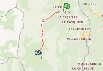
Trail Walking of 7.7 km to be discovered at Provence-Alpes-Côte d'Azur, Hautes-Alpes, Arvieux. This trail is proposed by CLP01.
Description
sans la vairiante - 940D / 7,7Km
Positioning
Country:
France
Region :
Provence-Alpes-Côte d'Azur
Department/Province :
Hautes-Alpes
Municipality :
Arvieux
Location:
Unknown
Start:(Dec)
Start:(UTM)
320992 ; 4959668 (32T) N.
Comments