


Cassis et Mont Gibaou

chrifor
User
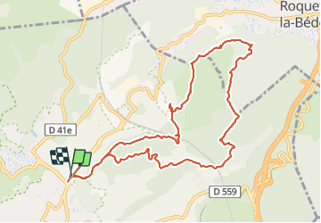

Length
13.2 km

Max alt
387 m

Uphill gradient
455 m
Km-Effort
19.2 km

Min alt
75 m

Downhill gradient
455 m
Boucle
Yes
Creation date :
2022-01-04 08:59:56.159
Updated on :
2022-01-07 10:13:05.426
5h32
Difficulty : Medium

FREE GPS app for hiking
 SityTrail
IGN / Geographical institutes
SityTrail Plus
The world is yours!
About
Trail Walking of 13.2 km to be discovered at Provence-Alpes-Côte d'Azur, Bouches-du-Rhône, Cassis. This trail is proposed by chrifor.
Description
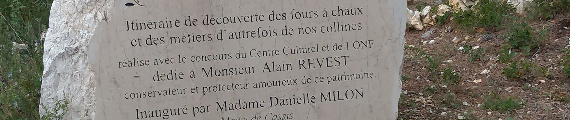
Déjà parcourue par beau temps et très belle vue, mais aujourd'hui (04/01/22) brume de mer et roche glissante.......
Photos


Positioning
Country:
France
Region :
Provence-Alpes-Côte d'Azur
Department/Province :
Bouches-du-Rhône
Municipality :
Cassis
Location:
Unknown
Start:(Dec)
Start:(UTM)
706682 ; 4788875 (31T) N.
Comments