


Rouze

caccini
User
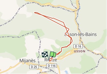

Length
8.5 km

Max alt
1246 m

Uphill gradient
554 m
Km-Effort
15.9 km

Min alt
974 m

Downhill gradient
560 m
Boucle
Yes
Creation date :
2022-01-06 08:41:57.263
Updated on :
2022-01-06 12:59:39.758
3h30
Difficulty : Medium

FREE GPS app for hiking
 SityTrail
IGN / Geographical institutes
SityTrail Plus
The world is yours!
About
Trail Walking of 8.5 km to be discovered at Occitania, Ariège, Rouze. This trail is proposed by caccini.
Description
Vers le col de Sira
Positioning
Country:
France
Region :
Occitania
Department/Province :
Ariège
Municipality :
Rouze
Location:
Unknown
Start:(Dec)
Start:(UTM)
423803 ; 4731294 (31T) N.
Comments