


Marcilly en Villette Plaines et forets

Rembliere
User

Length
11.7 km

Max alt
141 m

Uphill gradient
94 m
Km-Effort
12.9 km

Min alt
110 m

Downhill gradient
96 m
Boucle
Yes
Creation date :
2022-01-07 11:37:11.793
Updated on :
2022-01-07 11:39:20.108
2h56
Difficulty : Difficult

FREE GPS app for hiking
 SityTrail
IGN / Geographical institutes
SityTrail Plus
The world is yours!
About
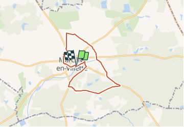
Trail Walking of 11.7 km to be discovered at Centre-Loire Valley, Loiret, Marcilly-en-Villette. This trail is proposed by Rembliere.
Positioning
Country:
France
Region :
Centre-Loire Valley
Department/Province :
Loiret
Municipality :
Marcilly-en-Villette
Location:
Unknown
Start:(Dec)
Start:(UTM)
426920 ; 5290343 (31T) N.
Comments