Trail Walking Blanzat - Blanzat_Plateau_Bade - Photo
 jagarnier
jagarnier

User GUIDE

© OpenStreetMap contributors
Length
Length
5.5 km
Max alt
Max alt
511 m
Uphill gradient
Uphill gradient
122 m
Km-Effort
Km-Effort  
7.2 km
Min alt
Min alt
396 m
Downhill gradient
Downhill gradient
122 m
Boucle
Boucle
Yes
Creation date :
2022-01-10 08:33:55.768
Updated on :
2023-11-15 16:25:03.744

(1 Reviews)

Walking
Walking
1h45
Difficulty : Easy

Scan this QR Code to open this trail in the SityTrail application

FREE GPS app for hiking

Logo SityTrail SityTrail

IGN / Geographical institutes

Download SityTrail from the App Store Download SityTrail from Google Play

Logo SityTrail SityTrail World

The world is yours!

Download SityTrail from the App Store Download SityTrail from Google Play Download SityTrail on Huawei AppGallery

About

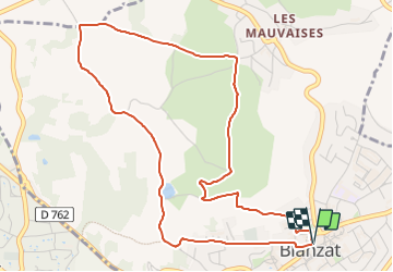
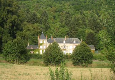
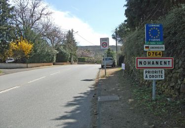
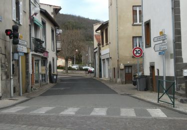
Trail Walking of 5.5 km to be discovered at Auvergne-Rhône-Alpes, Puy-de-Dôme, Blanzat. This trail is proposed by jagarnier.

Description

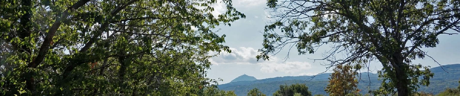
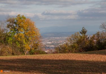
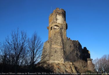
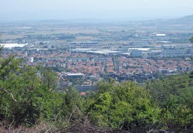
Le chemin serpente entre les vignes et les vergers offrant des vues exceptionnelles sur le versant nord des côtes de Clermont, la faille de Limagne et les volcans de la chaîne des Puys.

Elevation profile

Photos

Positioning

Country:
France
Region :
Auvergne-Rhône-Alpes
Department/Province :
Puy-de-Dôme
Municipality :
Blanzat
Location:
Unknown
Start:(UTM)
506020 ; 5075016 (31T) N.

Comments

Please log in to post a review or rate the element


Trails nearby

Trail Walking Durtol - Durtol_Cote_Pegnu - Photo
Walking
GUIDE
jagarnier

Walking

Easy
(1)
Durtol, Auvergne-Rhône-Alpes, Puy-de-Dôme, France
6.1 km | 9.1 km-effort
2h 0min
Yes
Trail Walking Sayat - Sayat_Repaire_Gaulois - Photo
Walking
GUIDE
jagarnier

Walking

Easy
(1)
Sayat, Auvergne-Rhône-Alpes, Puy-de-Dôme, France
6.1 km | 9.3 km-effort
1h 59min
Yes
Trail Mountain bike Volvic - Tour du Puy de Dôme en VTT - Photo
Mountain bike
tracegps

Mountain bike

Very difficult
(1)
Volvic, Auvergne-Rhône-Alpes, Puy-de-Dôme, France
62 km | 85 km-effort
5h 30min
Yes
Trail Walking Volvic - Les sources de Volvic - Photo
Walking
tracegps

Walking

Medium
(2)
Volvic, Auvergne-Rhône-Alpes, Puy-de-Dôme, France
10.9 km | 14.3 km-effort
3h 0min
Yes
Trail On foot Châteaugay - Les Côteaux du Plateau de Lachaud - Photo
On foot
PRO

On foot

Easy
Châteaugay, Auvergne-Rhône-Alpes, Puy-de-Dôme, France
14.2 km | 17.8 km-effort
4h 2min
Yes
Trail On foot Volvic - Les Sources de Volvic - Photo
On foot
PRO

On foot

Easy
Volvic, Auvergne-Rhône-Alpes, Puy-de-Dôme, France
10.5 km | 13.9 km-effort
3h 10min
Yes
Trail On foot Chanat-la-Mouteyre - Le Repaire des Gaulois - Photo
On foot
PRO

On foot

Easy
Chanat-la-Mouteyre, Auvergne-Rhône-Alpes, Puy-de-Dôme, France
6.5 km | 9.7 km-effort
2h 12min
Yes
Trail On foot Blanzat - Le Plateau de la Bade - Photo
On foot
PRO

On foot

Easy
Blanzat, Auvergne-Rhône-Alpes, Puy-de-Dôme, France
5.6 km | 7.2 km-effort
1h 38min
Yes
Trail On foot Cébazat - Le Col du Chevalard - Photo
On foot
PRO

On foot

Easy
Cébazat, Auvergne-Rhône-Alpes, Puy-de-Dôme, France
7.7 km | 10.4 km-effort
2h 21min
No


Close
My subscriptions