


Abbaye d'Aulne_Hourpes_Thuin-Remparts_Gozée_Aulne

denissculier
User
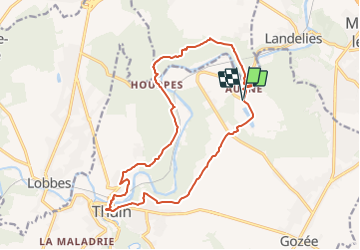

Length
15.5 km

Max alt
205 m

Uphill gradient
324 m
Km-Effort
19.8 km

Min alt
107 m

Downhill gradient
325 m
Boucle
Yes
Creation date :
2022-01-10 14:23:05.953
Updated on :
2022-01-10 17:38:45.305
4h24
Difficulty : Difficult

FREE GPS app for hiking
 SityTrail
IGN / Geographical institutes
SityTrail Plus
The world is yours!
About
Trail Nordic walking of 15.5 km to be discovered at Wallonia, Hainaut, Thuin. This trail is proposed by denissculier.
Positioning
Country:
Belgium
Region :
Wallonia
Department/Province :
Hainaut
Municipality :
Thuin
Location:
Unknown
Start:(Dec)
Start:(UTM)
594758 ; 5579979 (31U) N.
Comments