


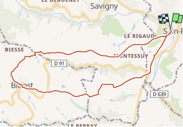
Saint Bel - Bibost

daniellebou
User

Length
10.8 km

Max alt
477 m

Uphill gradient
329 m
Km-Effort
15.2 km

Min alt
243 m

Downhill gradient
328 m
Boucle
Yes
Creation date :
2022-01-11 07:56:46.958
Updated on :
2022-01-11 10:54:21.471
2h56
Difficulty : Difficult

FREE GPS app for hiking
 SityTrail
IGN / Geographical institutes
SityTrail Plus
The world is yours!
About
Trail Walking of 10.8 km to be discovered at Auvergne-Rhône-Alpes, Rhône, Sain-Bel. This trail is proposed by daniellebou.
Positioning
Country:
France
Region :
Auvergne-Rhône-Alpes
Department/Province :
Rhône
Municipality :
Sain-Bel
Location:
Unknown
Start:(Dec)
Start:(UTM)
624089 ; 5074240 (31T) N.
Comments
Attention à la fin de la randonnée Elle longe la nationale