


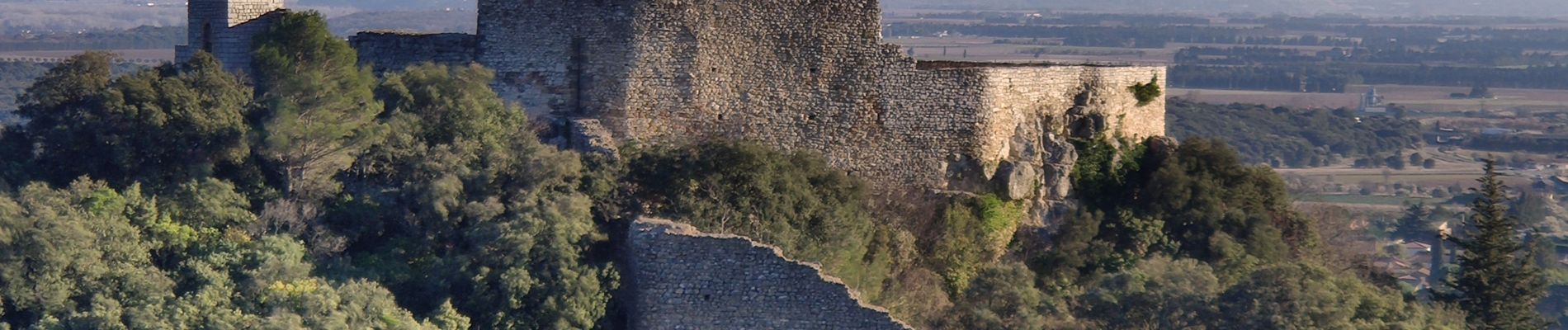
Cabrières- Lédenon château

rando30129
User
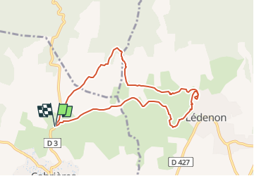

Length
8.9 km

Max alt
212 m

Uphill gradient
126 m
Km-Effort
10.6 km

Min alt
148 m

Downhill gradient
125 m
Boucle
Yes
Creation date :
2022-01-11 12:56:58.036
Updated on :
2023-04-11 17:42:05.516
2h24
Difficulty : Medium

FREE GPS app for hiking
 SityTrail
IGN / Geographical institutes
SityTrail Plus
The world is yours!
About
Trail Walking of 8.9 km to be discovered at Occitania, Gard, Cabrières. This trail is proposed by rando30129.
Photos


Positioning
Country:
France
Region :
Occitania
Department/Province :
Gard
Municipality :
Cabrières
Location:
Unknown
Start:(Dec)
Start:(UTM)
618259 ; 4863281 (31T) N.
Comments