


la Goulandiere

jphugon
User
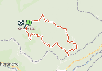

Length
9.8 km

Max alt
1237 m

Uphill gradient
568 m
Km-Effort
17.4 km

Min alt
908 m

Downhill gradient
567 m
Boucle
Yes
Creation date :
2022-01-13 08:34:04.514
Updated on :
2022-01-13 14:31:47.088
3h26
Difficulty : Very easy

FREE GPS app for hiking
 SityTrail
IGN / Geographical institutes
SityTrail Plus
The world is yours!
About
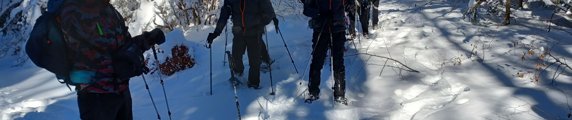
Trail Snowshoes of 9.8 km to be discovered at Auvergne-Rhône-Alpes, Isère, Presles. This trail is proposed by jphugon.
Description
départ Charmeil
Photos


Positioning
Country:
France
Region :
Auvergne-Rhône-Alpes
Department/Province :
Isère
Municipality :
Presles
Location:
Unknown
Start:(Dec)
Start:(UTM)
689052 ; 4994832 (31T) N.
Comments