


st siffret pont de bornegre mines de phosphate

Dan30
User

Length
8.8 km

Max alt
210 m

Uphill gradient
188 m
Km-Effort
11.3 km

Min alt
71 m

Downhill gradient
186 m
Boucle
Yes
Creation date :
2022-01-13 12:52:17.658
Updated on :
2022-01-17 17:27:07.569
2h27
Difficulty : Medium

FREE GPS app for hiking
 SityTrail
IGN / Geographical institutes
SityTrail Plus
The world is yours!
About
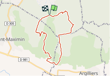
Trail Walking of 8.8 km to be discovered at Occitania, Gard, Saint-Siffret. This trail is proposed by Dan30.
Positioning
Country:
France
Region :
Occitania
Department/Province :
Gard
Municipality :
Saint-Siffret
Location:
Unknown
Start:(Dec)
Start:(UTM)
618143 ; 4873292 (31T) N.
Comments