


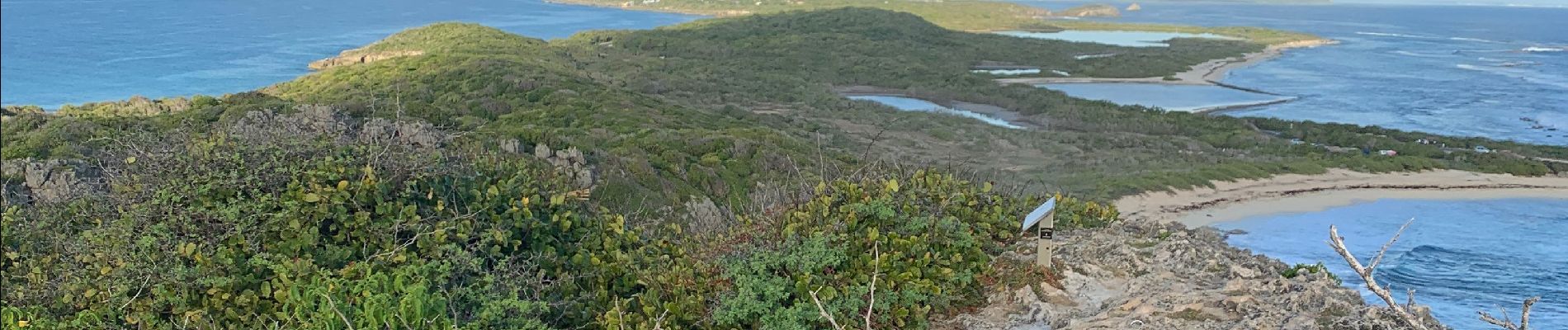
Anse la gourde

sameja
User
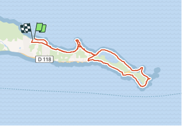

Length
12.2 km

Max alt
30 m

Uphill gradient
150 m
Km-Effort
14.2 km

Min alt
-1 m

Downhill gradient
148 m
Boucle
Yes
Creation date :
2022-01-15 10:19:47.0
Updated on :
2022-01-15 12:40:30.736
2h20
Difficulty : Medium

FREE GPS app for hiking
 SityTrail
IGN / Geographical institutes
SityTrail Plus
The world is yours!
About
Trail Trail of 12.2 km to be discovered at Guadeloupe, Unknown, Saint-François. This trail is proposed by sameja.
Description
Pointe des châteaux
Photos


Positioning
Country:
France
Region :
Guadeloupe
Department/Province :
Unknown
Municipality :
Saint-François
Location:
Unknown
Start:(Dec)
Start:(UTM)
690930 ; 1798298 (20Q) N.
Comments