


D15 - GR 10 Var

loic09
User
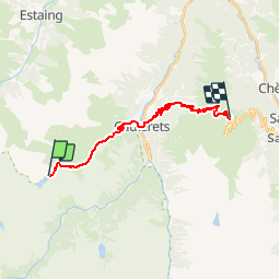

Length
18.8 km

Max alt
1984 m

Uphill gradient
1037 m
Km-Effort
34 km

Min alt
930 m

Downhill gradient
1370 m
Boucle
No
Creation date :
2014-12-10 00:00:00.0
Updated on :
2014-12-10 00:00:00.0
6h52
Difficulty : Medium

FREE GPS app for hiking
 SityTrail
IGN / Geographical institutes
SityTrail Plus
The world is yours!
About
Trail Walking of 18.8 km to be discovered at Occitania, Hautespyrenees, Cauterets. This trail is proposed by loic09.
Description
Lac d'Hilheou/Bederet
Positioning
Country:
France
Region :
Occitania
Department/Province :
Hautespyrenees
Municipality :
Cauterets
Location:
Unknown
Start:(Dec)
Start:(UTM)
730928 ; 4749825 (30T) N.
Comments