


Tracé

authentik escapade
User

Length
5.7 km

Max alt
258 m

Uphill gradient
161 m
Km-Effort
7.8 km

Min alt
174 m

Downhill gradient
165 m
Boucle
Yes
Creation date :
2022-01-18 10:52:43.41
Updated on :
2024-10-05 19:07:58.472
1h46
Difficulty : Medium

FREE GPS app for hiking
 SityTrail
IGN / Geographical institutes
SityTrail Plus
The world is yours!
About
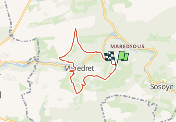
Trail Walking of 5.7 km to be discovered at Wallonia, Namur, Anhée. This trail is proposed by authentik escapade.
Description
Départ : Parking de l'abbaye de Maredsous
Tracé/balisage : 2
A voir :
- Abbaye de Maredsous centre d'acceuil
- Abbaye de Maredret
- Chapelles
- Point de vue
- Château de Maredsous
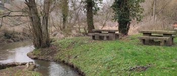
Photos


Points of interest


Positioning
Country:
Belgium
Region :
Wallonia
Department/Province :
Namur
Municipality :
Anhée
Location:
Unknown
Start:(Dec)
Start:(UTM)
625749 ; 5573476 (31U) N.
Comments