


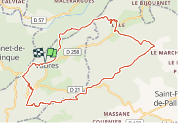
Vabres col de Banes

JMJ42
User

Length
12.4 km

Max alt
476 m

Uphill gradient
391 m
Km-Effort
17.7 km

Min alt
251 m

Downhill gradient
396 m
Boucle
Yes
Creation date :
2022-01-18 08:25:10.579
Updated on :
2022-01-18 14:08:50.771
3h40
Difficulty : Easy

FREE GPS app for hiking
 SityTrail
IGN / Geographical institutes
SityTrail Plus
The world is yours!
About
Trail Walking of 12.4 km to be discovered at Occitania, Gard, Vabres. This trail is proposed by JMJ42.
Positioning
Country:
France
Region :
Occitania
Department/Province :
Gard
Municipality :
Vabres
Location:
Unknown
Start:(Dec)
Start:(UTM)
571125 ; 4875835 (31T) N.
Comments