


Cap vert 17 janv 22

gdruet
User
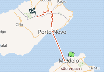

Length
48 km

Max alt
1470 m

Uphill gradient
1675 m
Km-Effort
66 km

Min alt
0 m

Downhill gradient
466 m
Boucle
No
Creation date :
2022-01-17 07:52:29.029
Updated on :
2022-03-11 13:08:52.483
4h35
Difficulty : Easy

FREE GPS app for hiking
 SityTrail
IGN / Geographical institutes
SityTrail Plus
The world is yours!
About
Trail Walking of 48 km to be discovered at Unknown, São Vicente. This trail is proposed by gdruet.
Description
Cap Vert 2
Positioning
Country:
Cape Verde
Region :
Unknown
Department/Province :
São Vicente
Municipality :
Unknown
Location:
Unknown
Start:(Dec)
Start:(UTM)
713751 ; 1868116 (26Q) N.
Comments