


Boffres1

ajd26
User
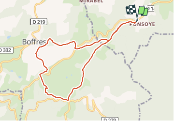

Length
9.3 km

Max alt
729 m

Uphill gradient
294 m
Km-Effort
13.3 km

Min alt
573 m

Downhill gradient
298 m
Boucle
Yes
Creation date :
2022-01-19 13:16:07.0
Updated on :
2022-01-24 09:17:40.492
2h40
Difficulty : Very easy

FREE GPS app for hiking
 SityTrail
IGN / Geographical institutes
SityTrail Plus
The world is yours!
About
Trail Walking of 9.3 km to be discovered at Auvergne-Rhône-Alpes, Ardèche, Alboussière. This trail is proposed by ajd26.
Positioning
Country:
France
Region :
Auvergne-Rhône-Alpes
Department/Province :
Ardèche
Municipality :
Alboussière
Location:
Unknown
Start:(Dec)
Start:(UTM)
637291 ; 4976162 (31T) N.
Comments