Trail Walking Ziortza-Bolibar - JFT YB Étape 28 26-5-2014  - Photo
 jeff2
jeff2

User

© OpenStreetMap contributors
Length
Length
30 km
Max alt
Max alt
370 m
Uphill gradient
Uphill gradient
889 m
Km-Effort
Km-Effort  
42 km
Min alt
Min alt
3 m
Downhill gradient
Downhill gradient
984 m
Boucle
Boucle
No
Creation date :
2014-12-10 00:00:00.0
Updated on :
2014-12-10 00:00:00.0

(0 Reviews)

Walking
Walking
7h31
Difficulty : Medium

Scan this QR Code to open this trail in the SityTrail application

FREE GPS app for hiking

Logo SityTrail SityTrail

IGN / Geographical institutes

Download SityTrail from the App Store Download SityTrail from Google Play

Logo SityTrail SityTrail World

The world is yours!

Download SityTrail from the App Store Download SityTrail from Google Play Download SityTrail on Huawei AppGallery

About

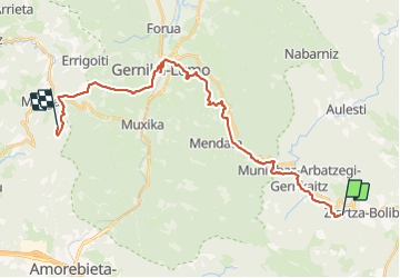
Trail Walking of 30 km to be discovered at Autonomous Community of the Basque Country, Biscay, Ziortza-Bolibar. This trail is proposed by jeff2.

Description

Bolibar à Isterika

Elevation profile

Photos

Points of interest

Point of interest Guernica - Point 15 - Photo
jeff2
GUERNICA 

Positioning

Country:
Spain
Region :
Autonomous Community of the Basque Country
Department/Province :
Biscay
Municipality :
Ziortza-Bolibar
Location:
Unknown
Start:(UTM)
535283 ; 4788506 (30T) N.

Trails nearby

Trail Walking Ziortza-Bolibar - 005 Zenarruza - Eskerika - Photo
Walking
Bonsaicd

Walking

Very easy
Ziortza-Bolibar, Autonomous Community of the Basque Country, Biscay, Spain
27 km | 39 km-effort
8h 24min
No
Trail Walking Ziortza-Bolibar - 05 Ziortza Gernika - Photo
Walking
Bonsaicd

Walking

Very difficult
Ziortza-Bolibar, Autonomous Community of the Basque Country, Biscay, Spain
17.3 km | 24 km-effort
4h 52min
No
Trail Walking Ziortza-Bolibar - 046 Ziortza Gernika - Photo
Walking
lucille

Walking

Very easy
Ziortza-Bolibar, Autonomous Community of the Basque Country, Biscay, Spain
17.3 km | 24 km-effort
4h 52min
No


Close
My subscriptions