


Rotalier par les Granges

drarep
User
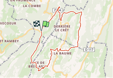

Length
9.6 km

Max alt
568 m

Uphill gradient
263 m
Km-Effort
13.1 km

Min alt
436 m

Downhill gradient
264 m
Boucle
Yes
Creation date :
2022-01-22 07:42:06.032
Updated on :
2022-01-22 07:43:37.853
2h15
Difficulty : Easy

FREE GPS app for hiking
 SityTrail
IGN / Geographical institutes
SityTrail Plus
The world is yours!
About
Trail Walking of 9.6 km to be discovered at Bourgogne-Franche-Comté, Jura, Rotalier. This trail is proposed by drarep.
Positioning
Country:
France
Region :
Bourgogne-Franche-Comté
Department/Province :
Jura
Municipality :
Rotalier
Location:
Unknown
Start:(Dec)
Start:(UTM)
689953 ; 5160737 (31T) N.
Comments