


depart perquelin, dome de bellefont , retour au gite les 4 chemins

gerardmicheline
User

Length
14.7 km

Max alt
1956 m

Uphill gradient
1092 m
Km-Effort
30 km

Min alt
826 m

Downhill gradient
1272 m
Boucle
No
Creation date :
2022-01-22 15:43:42.466
Updated on :
2022-01-22 15:45:00.786
6h47
Difficulty : Very difficult

FREE GPS app for hiking
 SityTrail
IGN / Geographical institutes
SityTrail Plus
The world is yours!
About
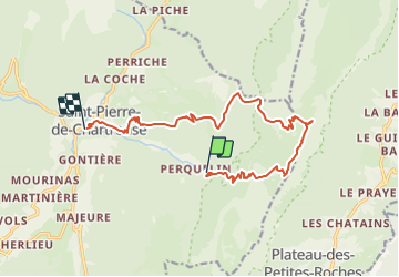
Trail Walking of 14.7 km to be discovered at Auvergne-Rhône-Alpes, Isère, Saint-Pierre-de-Chartreuse. This trail is proposed by gerardmicheline.
Positioning
Country:
France
Region :
Auvergne-Rhône-Alpes
Department/Province :
Isère
Municipality :
Saint-Pierre-de-Chartreuse
Location:
Unknown
Start:(Dec)
Start:(UTM)
723182 ; 5023650 (31T) N.
Comments