


2022-01-23_14h57m43_10201678

jpb83
User
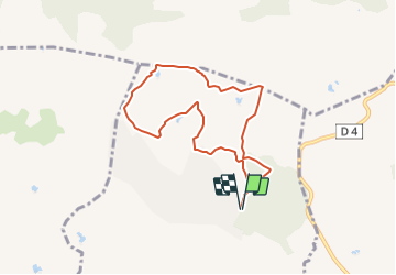

Length
7.7 km

Max alt
174 m

Uphill gradient
174 m
Km-Effort
10 km

Min alt
68 m

Downhill gradient
174 m
Boucle
Yes
Creation date :
2022-01-23 13:57:43.771
Updated on :
2022-01-23 14:41:41.172
1h00
Difficulty : Medium

FREE GPS app for hiking
 SityTrail
IGN / Geographical institutes
SityTrail Plus
The world is yours!
About
Trail Trail of 7.7 km to be discovered at Provence-Alpes-Côte d'Azur, Var, Puget-sur-Argens. This trail is proposed by jpb83.
Positioning
Country:
France
Region :
Provence-Alpes-Côte d'Azur
Department/Province :
Var
Municipality :
Puget-sur-Argens
Location:
Unknown
Start:(Dec)
Start:(UTM)
313735 ; 4818598 (32T) N.
Comments