


2022-01-23_15h09m50_reperage-du-trail-des-mange-lamberts-25km

jpb83
User
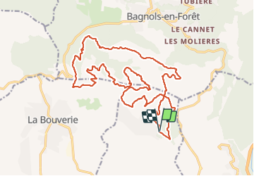

Length
26 km

Max alt
419 m

Uphill gradient
979 m
Km-Effort
39 km

Min alt
55 m

Downhill gradient
981 m
Boucle
Yes
Creation date :
2022-01-23 14:09:51.022
Updated on :
2022-01-23 14:40:12.237
2h00
Difficulty : Difficult

FREE GPS app for hiking
 SityTrail
IGN / Geographical institutes
SityTrail Plus
The world is yours!
About
Trail Trail of 26 km to be discovered at Provence-Alpes-Côte d'Azur, Var, Puget-sur-Argens. This trail is proposed by jpb83.
Description
Trace de la séance du 25/02/2017 lors du repérage du trail 25km des Mange-Lamberts
Positioning
Country:
France
Region :
Provence-Alpes-Côte d'Azur
Department/Province :
Var
Municipality :
Puget-sur-Argens
Location:
Unknown
Start:(Dec)
Start:(UTM)
313761 ; 4818556 (32T) N.
Comments