


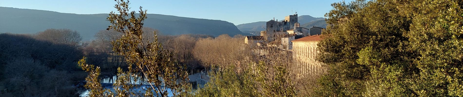
laroque, plateau de thaurac

jeanfcd
User
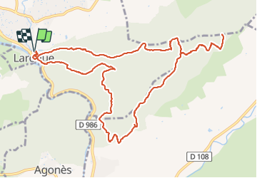

Length
14.1 km

Max alt
480 m

Uphill gradient
520 m
Km-Effort
21 km

Min alt
140 m

Downhill gradient
519 m
Boucle
Yes
Creation date :
2022-01-23 10:16:50.263
Updated on :
2022-01-23 15:57:36.343
4h03
Difficulty : Medium

FREE GPS app for hiking
 SityTrail
IGN / Geographical institutes
SityTrail Plus
The world is yours!
About
Trail Walking of 14.1 km to be discovered at Occitania, Hérault, Laroque. This trail is proposed by jeanfcd.
Photos


31 photos in total. Please click on a photo to see them all in the gallery.
Positioning
Country:
France
Region :
Occitania
Department/Province :
Hérault
Municipality :
Laroque
Location:
Unknown
Start:(Dec)
Start:(UTM)
558085 ; 4863630 (31T) N.
Comments