


Chabanon 230122

David25400
User GUIDE
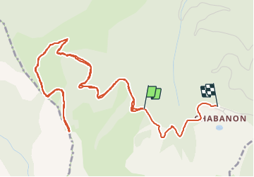

Length
7.8 km

Max alt
1720 m

Uphill gradient
272 m
Km-Effort
11.4 km

Min alt
1568 m

Downhill gradient
258 m
Boucle
No
Creation date :
2022-01-23 13:26:33.473
Updated on :
2022-01-23 16:28:55.419
3h01
Difficulty : Very easy

FREE GPS app for hiking
 SityTrail
IGN / Geographical institutes
SityTrail Plus
The world is yours!
About
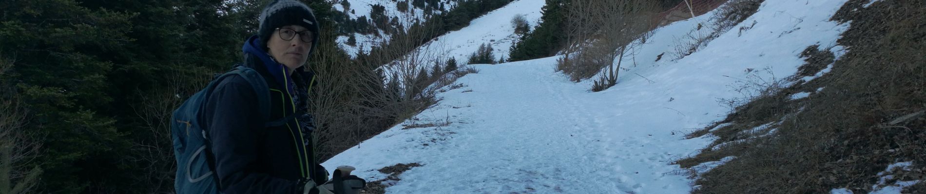
Trail Walking of 7.8 km to be discovered at Provence-Alpes-Côte d'Azur, Alpes-de-Haute-Provence, Selonnet. This trail is proposed by David25400.
Photos


Positioning
Country:
France
Region :
Provence-Alpes-Côte d'Azur
Department/Province :
Alpes-de-Haute-Provence
Municipality :
Selonnet
Location:
Unknown
Start:(Dec)
Start:(UTM)
283657 ; 4914019 (32T) N.
Comments