


beaurepaire

RoMo
User

Length
12.1 km

Max alt
133 m

Uphill gradient
174 m
Km-Effort
14.4 km

Min alt
61 m

Downhill gradient
174 m
Boucle
Yes
Creation date :
2022-01-23 13:10:14.141
Updated on :
2022-01-23 16:40:16.167
2h56
Difficulty : Easy

FREE GPS app for hiking
 SityTrail
IGN / Geographical institutes
SityTrail Plus
The world is yours!
About
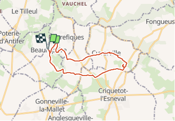
Trail Walking of 12.1 km to be discovered at Normandy, Seine-Maritime, Beaurepaire. This trail is proposed by RoMo.
Description
beau parcours,nombreux sentiers
Positioning
Country:
France
Region :
Normandy
Department/Province :
Seine-Maritime
Municipality :
Beaurepaire
Location:
Unknown
Start:(Dec)
Start:(UTM)
299438 ; 5505176 (31U) N.
Comments