


la planche... Le refuge

PatriceCocuaud
User
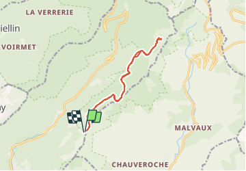

Length
12.1 km

Max alt
1086 m

Uphill gradient
370 m
Km-Effort
17 km

Min alt
949 m

Downhill gradient
372 m
Boucle
Yes
Creation date :
2022-01-24 13:14:04.566
Updated on :
2022-01-24 16:14:39.851
1h43
Difficulty : Easy

FREE GPS app for hiking
 SityTrail
IGN / Geographical institutes
SityTrail Plus
The world is yours!
About
Trail Cross-country skiing of 12.1 km to be discovered at Bourgogne-Franche-Comté, Haute-Saône, Plancher-les-Mines. This trail is proposed by PatriceCocuaud.
Positioning
Country:
France
Region :
Bourgogne-Franche-Comté
Department/Province :
Haute-Saône
Municipality :
Plancher-les-Mines
Location:
Unknown
Start:(Dec)
Start:(UTM)
333626 ; 5293760 (32T) N.
Comments