


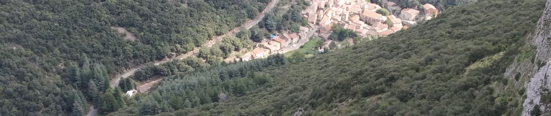
Pradelles,roc de l'aigle,cabrespine,pradelles

Dupleix
User
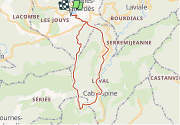

Length
15.3 km

Max alt
873 m

Uphill gradient
625 m
Km-Effort
24 km

Min alt
313 m

Downhill gradient
624 m
Boucle
Yes
Creation date :
2022-01-24 18:34:06.416
Updated on :
2022-01-24 18:40:20.294
5h50
Difficulty : Difficult

FREE GPS app for hiking
 SityTrail
IGN / Geographical institutes
SityTrail Plus
The world is yours!
About
Trail On foot of 15.3 km to be discovered at Occitania, Aude, Pradelles-Cabardès. This trail is proposed by Dupleix.
Description
Boucle au depart de pradelles cabardès par la voie romaine avec les purennees en fo'd d'ecran et des paysages vertigineux.
Photos


Positioning
Country:
France
Region :
Occitania
Department/Province :
Aude
Municipality :
Pradelles-Cabardès
Location:
Unknown
Start:(Dec)
Start:(UTM)
454653 ; 4805592 (31T) N.
Comments