


sortie rapide

bernardcornu
User
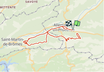

Length
23 km

Max alt
574 m

Uphill gradient
522 m
Km-Effort
30 km

Min alt
378 m

Downhill gradient
524 m
Boucle
Yes
Creation date :
2022-01-25 12:42:52.897
Updated on :
2022-01-25 14:24:28.046
1h26
Difficulty : Medium

FREE GPS app for hiking
 SityTrail
IGN / Geographical institutes
SityTrail Plus
The world is yours!
About
Trail Mountain bike of 23 km to be discovered at Provence-Alpes-Côte d'Azur, Alpes-de-Haute-Provence, Allemagne-en-Provence. This trail is proposed by bernardcornu.
Positioning
Country:
France
Region :
Provence-Alpes-Côte d'Azur
Department/Province :
Alpes-de-Haute-Provence
Municipality :
Allemagne-en-Provence
Location:
Unknown
Start:(Dec)
Start:(UTM)
260079 ; 4851744 (32T) N.
Comments