


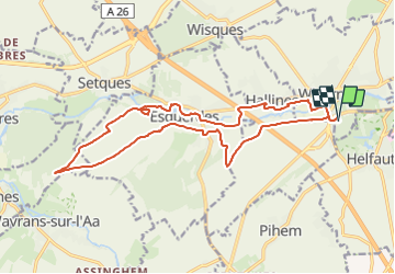
Rando des 2 Vallées 2022 (17,5Kms Dén P 235m)

alain62rando
User

Length
17.5 km

Max alt
142 m

Uphill gradient
235 m
Km-Effort
21 km

Min alt
23 m

Downhill gradient
234 m
Boucle
Yes
Creation date :
2022-01-27 14:11:00.582
Updated on :
2022-02-14 16:02:25.636
4h40
Difficulty : Medium

FREE GPS app for hiking
 SityTrail
IGN / Geographical institutes
SityTrail Plus
The world is yours!
About
Trail Walking of 17.5 km to be discovered at Hauts-de-France, Pas-de-Calais, Wizernes. This trail is proposed by alain62rando.
Description
Ravitaillement N°1 8Kms
Ravitaillement N°2 12,2Kms
Positioning
Country:
France
Region :
Hauts-de-France
Department/Province :
Pas-de-Calais
Municipality :
Wizernes
Location:
Unknown
Start:(Dec)
Start:(UTM)
445714 ; 5617263 (31U) N.
Comments