


14142919-Chalam/Evuaz

gerardmicheline
User

Length
9.7 km

Max alt
1519 m

Uphill gradient
612 m
Km-Effort
17.9 km

Min alt
1076 m

Downhill gradient
613 m
Boucle
Yes
Creation date :
2022-01-28 13:29:06.758
Updated on :
2022-01-28 13:29:42.415
4h03
Difficulty : Difficult

FREE GPS app for hiking
 SityTrail
IGN / Geographical institutes
SityTrail Plus
The world is yours!
About
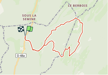
Trail Walking of 9.7 km to be discovered at Auvergne-Rhône-Alpes, Ain, Champfromier. This trail is proposed by gerardmicheline.
Positioning
Country:
France
Region :
Auvergne-Rhône-Alpes
Department/Province :
Ain
Municipality :
Champfromier
Location:
Unknown
Start:(Dec)
Start:(UTM)
718877 ; 5126625 (31T) N.
Comments