


RS-Le-Mottier-le-bois-des-Rivoires

raymondfn
User
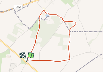

Length
4.3 km

Max alt
507 m

Uphill gradient
32 m
Km-Effort
4.7 km

Min alt
482 m

Downhill gradient
32 m
Boucle
Yes
Creation date :
2022-01-29 14:14:06.129
Updated on :
2022-01-29 14:17:24.368
1h03
Difficulty : Easy

FREE GPS app for hiking
 SityTrail
IGN / Geographical institutes
SityTrail Plus
The world is yours!
About
Trail Walking of 4.3 km to be discovered at Auvergne-Rhône-Alpes, Isère, Mottier. This trail is proposed by raymondfn.
Positioning
Country:
France
Region :
Auvergne-Rhône-Alpes
Department/Province :
Isère
Municipality :
Mottier
Location:
Unknown
Start:(Dec)
Start:(UTM)
681394 ; 5032772 (31T) N.
Comments