Trail Walking Saint-Joseph-des-Bancs - 07 st joseph les bancs - Photo
© OpenStreetMap contributors
Length
Length
18.4 km
Max alt
Max alt
1125 m
Uphill gradient
Uphill gradient
782 m
Km-Effort
Km-Effort  
29 km
Min alt
Min alt
571 m
Downhill gradient
Downhill gradient
787 m
Boucle
Boucle
Yes
Creation date :
2022-01-29 08:27:16.128
Updated on :
2022-01-29 16:16:14.241

(0 Reviews)

Walking
Walking
7h47
Difficulty : Easy

Scan this QR Code to open this trail in the SityTrail application

FREE GPS app for hiking

Logo SityTrail SityTrail

IGN / Geographical institutes

Download SityTrail from the App Store Download SityTrail from Google Play

Logo SityTrail SityTrail World

The world is yours!

Download SityTrail from the App Store Download SityTrail from Google Play Download SityTrail on Huawei AppGallery

About

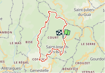
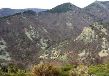
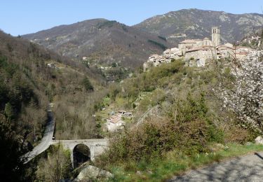
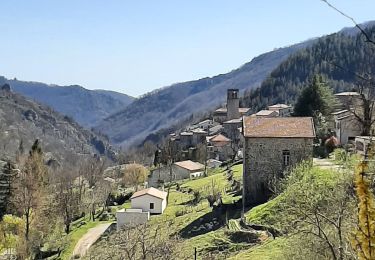
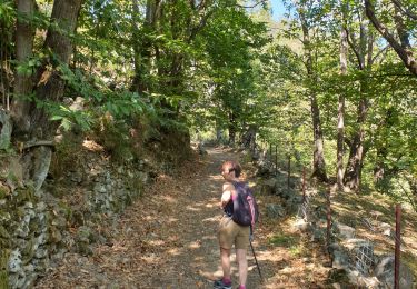
Trail Walking of 18.4 km to be discovered at Auvergne-Rhône-Alpes, Ardèche, Saint-Joseph-des-Bancs. This trail is proposed by himba26100.

Description

gêne
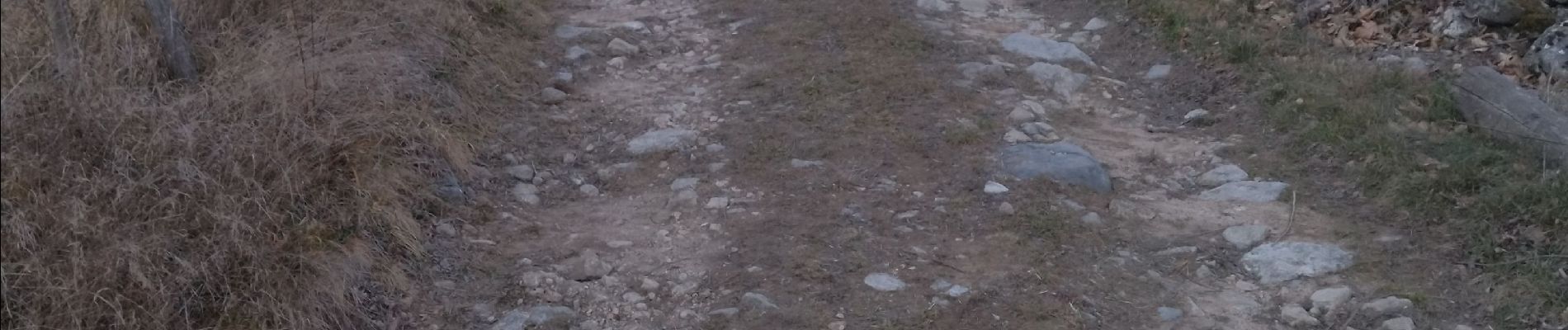
rester sur le balisage au départ si on ronces  
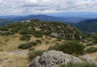
belle rando a refaire

Elevation profile

Photos

Positioning

Country:
France
Region :
Auvergne-Rhône-Alpes
Department/Province :
Ardèche
Municipality :
Saint-Joseph-des-Bancs
Location:
Unknown
Start:(UTM)
612278 ; 4955631 (31T) N.

Trails nearby

Trail Walking Saint-Étienne-de-Boulogne - Le Rastelas 14km - Photo
Walking
GUIDE
thonyc

Walking

Difficult
Saint-Étienne-de-Boulogne, Auvergne-Rhône-Alpes, Ardèche, France
13.8 km | 21 km-effort
4h 24min
Yes
Trail Walking Gourdon - Col de la Fayolle - Rocher de Gourdon  - Photo
Walking
coureursdecretes

Walking

Difficult
(1)
Gourdon, Auvergne-Rhône-Alpes, Ardèche, France
12.4 km | 17.1 km-effort
5h 10min
No
Trail Walking Vallées-d'Antraigues-Asperjoc - 07_antraigues_7km400m - Photo
Walking
SyMA

Walking

Easy
Vallées-d'Antraigues-Asperjoc, Auvergne-Rhône-Alpes, Ardèche, France
8.6 km | 13.2 km-effort
3h 7min
Yes
Trail Walking Ajoux - 07 sarrasset ajoux - Photo
Walking
himba26100

Walking

Medium
Ajoux, Auvergne-Rhône-Alpes, Ardèche, France
16.3 km | 25 km-effort
7h 3min
No
Trail Walking Vallées-d'Antraigues-Asperjoc - Le Mazoyer - Le rocher des aigles - Photo
Walking
coureursdecretes

Walking

Very difficult
Vallées-d'Antraigues-Asperjoc, Auvergne-Rhône-Alpes, Ardèche, France
12.8 km | 21 km-effort
5h 46min
Yes
Trail Walking Vallées-d'Antraigues-Asperjoc - Antraïgues-Gamondes 17km - Photo
Walking
GUIDE
thonyc

Walking

Difficult
Vallées-d'Antraigues-Asperjoc, Auvergne-Rhône-Alpes, Ardèche, France
17.1 km | 25 km-effort
5h 30min
Yes
Trail Walking Vallées-d'Antraigues-Asperjoc - Le Mazoyer depuis Antraigues. - Photo
Walking
dcharbonnier

Walking

Medium
Vallées-d'Antraigues-Asperjoc, Auvergne-Rhône-Alpes, Ardèche, France
14.1 km | 21 km-effort
4h 37min
Yes
Trail Walking Vallées-d'Antraigues-Asperjoc - Château de Craux par Genestelle,  - Photo
Walking
dcharbonnier

Walking

Easy
(1)
Vallées-d'Antraigues-Asperjoc, Auvergne-Rhône-Alpes, Ardèche, France
8.8 km | 13.1 km-effort
4h 6min
Yes
Trail Walking Vallées-d'Antraigues-Asperjoc - antraigues la violle - Photo
Walking
matrixe07

Walking

Very easy
Vallées-d'Antraigues-Asperjoc, Auvergne-Rhône-Alpes, Ardèche, France
12.6 km | 19.1 km-effort
3h 41min
Yes


Close
My subscriptions