


20220130 Rouvray cegelec

Childebert
User

Length
5.7 km

Max alt
75 m

Uphill gradient
58 m
Km-Effort
6.4 km

Min alt
35 m

Downhill gradient
59 m
Boucle
Yes
Creation date :
2022-01-30 12:33:59.348
Updated on :
2022-01-31 13:10:49.776
1h39
Difficulty : Easy

FREE GPS app for hiking
 SityTrail
IGN / Geographical institutes
SityTrail Plus
The world is yours!
About
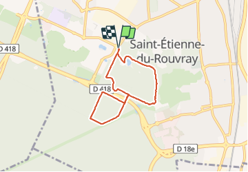
Trail Walking of 5.7 km to be discovered at Normandy, Seine-Maritime, Saint-Étienne-du-Rouvray. This trail is proposed by Childebert.
Positioning
Country:
France
Region :
Normandy
Department/Province :
Seine-Maritime
Municipality :
Saint-Étienne-du-Rouvray
Location:
Unknown
Start:(Dec)
Start:(UTM)
360621 ; 5471873 (31U) N.
Comments