


le Garri

amiral13
User GUIDE
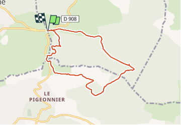

Length
8.4 km

Max alt
485 m

Uphill gradient
184 m
Km-Effort
10.9 km

Min alt
335 m

Downhill gradient
183 m
Boucle
Yes
Creation date :
2022-01-30 13:27:00.434
Updated on :
2022-01-30 15:35:35.865
2h08
Difficulty : Easy

FREE GPS app for hiking
 SityTrail
IGN / Geographical institutes
SityTrail Plus
The world is yours!
About
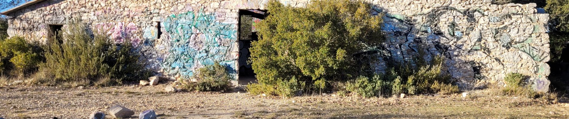
Trail Walking of 8.4 km to be discovered at Provence-Alpes-Côte d'Azur, Bouches-du-Rhône, Peynier. This trail is proposed by amiral13.
Photos


Positioning
Country:
France
Region :
Provence-Alpes-Côte d'Azur
Department/Province :
Bouches-du-Rhône
Municipality :
Peynier
Location:
Unknown
Start:(Dec)
Start:(UTM)
711307 ; 4810608 (31T) N.
Comments
merci pour ce partage une belle randonnée variée