


Briançon Schappe-3 têtes

Orcal37
User GUIDE
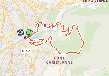

Length
6.5 km

Max alt
1443 m

Uphill gradient
337 m
Km-Effort
11 km

Min alt
1222 m

Downhill gradient
338 m
Boucle
Yes
Creation date :
2014-12-10 00:00:00.0
Updated on :
2021-09-23 17:48:29.508
2h05
Difficulty : Easy

FREE GPS app for hiking
 SityTrail
IGN / Geographical institutes
SityTrail Plus
The world is yours!
About
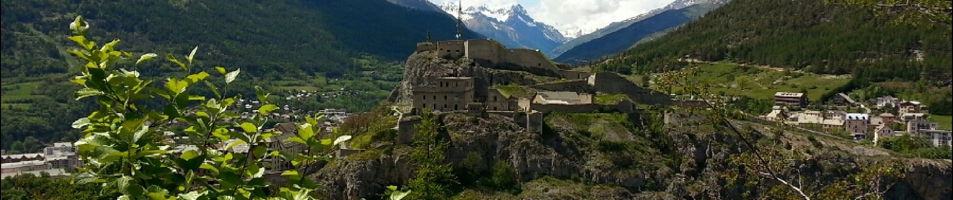
Trail Walking of 6.5 km to be discovered at Provence-Alpes-Côte d'Azur, Hautes-Alpes, Briançon. This trail is proposed by Orcal37.
Description
Briançon Boucle Parc de la Schappe - Cité Vauban - Fort des Trois Têtes
Photos


Positioning
Country:
France
Region :
Provence-Alpes-Côte d'Azur
Department/Province :
Hautes-Alpes
Municipality :
Briançon
Location:
Unknown
Start:(Dec)
Start:(UTM)
313478 ; 4974051 (32T) N.
Comments
Très belle promenade avec des enfants, ombragées , avec vue sur Briancon , avec ruisseau