Trail On foot Saint-Vallier-de-Thiey - Col du Pilon La Marbrière Route des 3 Ponts Croix de Cabris 3543 ET - Photo

Col du Pilon La Marbrière Route des 3 Ponts Croix de Cabris 3543 ET

© OpenStreetMap contributors
Length
Length
15.5 km
Max alt
Max alt
1087 m
Uphill gradient
Uphill gradient
605 m
Km-Effort
Km-Effort  
24 km
Min alt
Min alt
527 m
Downhill gradient
Downhill gradient
607 m
Boucle
Boucle
Yes
Creation date :
2022-02-01 08:00:56.873
Updated on :
2022-02-01 17:45:11.046

(0 Reviews)

On foot
On foot
5h20
Difficulty : Medium

Scan this QR Code to open this trail in the SityTrail application

FREE GPS app for hiking

Logo SityTrail SityTrail

IGN / Geographical institutes

Download SityTrail from the App Store Download SityTrail from Google Play

Logo SityTrail SityTrail World

The world is yours!

Download SityTrail from the App Store Download SityTrail from Google Play Download SityTrail on Huawei AppGallery

About

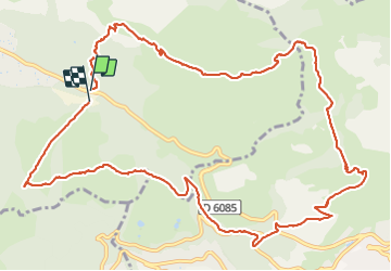
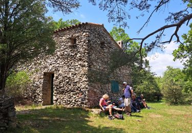
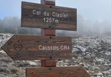
Trail On foot of 15.5 km to be discovered at Provence-Alpes-Côte d'Azur, Maritime Alps, Saint-Vallier-de-Thiey. This trail is proposed by verotrail.

Description

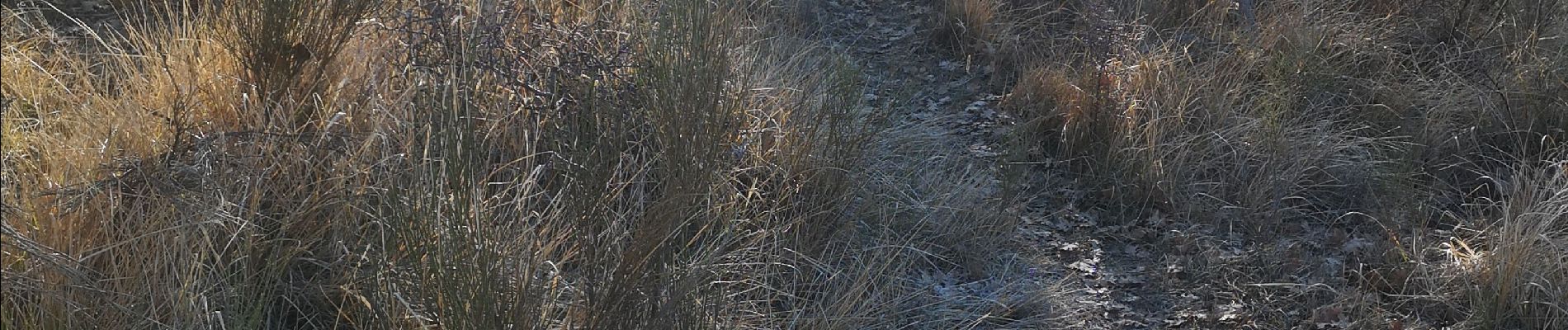
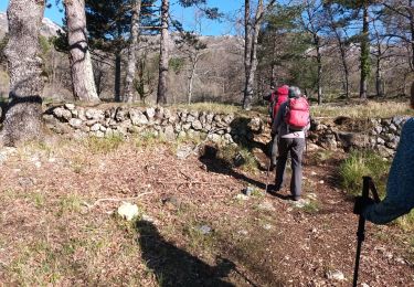
Entre 1 km et 1,500 km monter un peu plus haut que le tracé pour trouver le sentier à droite (photo couleur verte) ensuite il est bien marqué
(en traçant le parcourt je ne suis pas montée assez haut et lors du repérage en septembre j'ai oublié d'enregistrer ...d’où l'erreur)

Elevation profile

Photos

Points of interest

Point of interest Saint-Vallier-de-Thiey - N° 1 bis - Photo
verotrail
SAINT-VALLIER-DE-THIEY 

Positioning

Country:
France
Region :
Provence-Alpes-Côte d'Azur
Department/Province :
Maritime Alps
Municipality :
Saint-Vallier-de-Thiey
Location:
Unknown
Start:(UTM)
329350 ; 4839071 (32T) N.

Trails nearby

Trail Walking Grasse - petit rando au dessus de Grasse - Photo
Walking
patsure

Walking

Medium
(1)
Grasse, Provence-Alpes-Côte d'Azur, Maritime Alps, France
6 km | 10.6 km-effort
1h 55min
Yes
Trail On foot Grasse - Tour de la Marbrière - Photo
On foot
PRO

On foot

Easy
Grasse, Provence-Alpes-Côte d'Azur, Maritime Alps, France
5.5 km | 10 km-effort
2h 16min
Yes
Trail Mountain bike Grasse - vttour_2051 - Photo
Mountain bike
Reich

Mountain bike

Medium
(1)
Grasse, Provence-Alpes-Côte d'Azur, Maritime Alps, France
18.5 km | 27 km-effort
1h 42min
Yes
Trail Walking Saint-Vallier-de-Thiey - St Vallier de Thiey - Col du Ferrier - Castellaras de la Malle - Col du Pilon - Pierre Druidique - Photo
Walking
LtZIP

Walking

Medium
Saint-Vallier-de-Thiey, Provence-Alpes-Côte d'Azur, Maritime Alps, France
18.9 km | 28 km-effort
6h 18min
Yes
Trail Walking Saint-Vallier-de-Thiey - Montagne de Thiey 2 - Photo
Walking
ETMU5496

Walking

Medium
Saint-Vallier-de-Thiey, Provence-Alpes-Côte d'Azur, Maritime Alps, France
19.3 km | 31 km-effort
6h 57min
Yes
Trail Walking Grasse - La croix de Cbris - Photo
Walking
56jj

Walking

Easy
Grasse, Provence-Alpes-Côte d'Azur, Maritime Alps, France
14.1 km | 19 km-effort
5h 40min
Yes
Trail Walking Saint-Vallier-de-Thiey - montagne de Thiey-forêt de Nans-19-04-23 - Photo
Walking
Christiancordin

Walking

Medium
Saint-Vallier-de-Thiey, Provence-Alpes-Côte d'Azur, Maritime Alps, France
16.1 km | 26 km-effort
4h 15min
Yes
Trail Walking Saint-Vallier-de-Thiey - Col du Pilon : Colle maçon et haut Montet  - Photo
Walking
ETMU5496

Walking

Very difficult
Saint-Vallier-de-Thiey, Provence-Alpes-Côte d'Azur, Maritime Alps, France
23 km | 38 km-effort
8h 37min
Yes
Trail Walking Saint-Vallier-de-Thiey - Face Sud de la montagne de Thiey - Photo
Walking
Palimpseste

Walking

Medium
Saint-Vallier-de-Thiey, Provence-Alpes-Côte d'Azur, Maritime Alps, France
8.6 km | 14.7 km-effort
2h 11min
Yes


Close
My subscriptions