


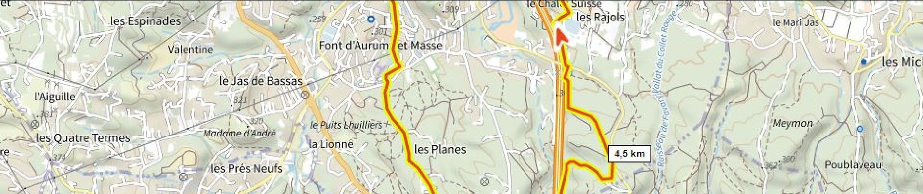
les Planes, le Chalet Suisse

ericberlin
User
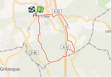

Length
7.5 km

Max alt
352 m

Uphill gradient
172 m
Km-Effort
9.8 km

Min alt
250 m

Downhill gradient
172 m
Boucle
Yes
Creation date :
2022-02-01 20:45:05.999
Updated on :
2023-06-05 15:29:09.262
2h13
Difficulty : Medium
40m
Difficulty : Easy

FREE GPS app for hiking
 SityTrail
IGN / Geographical institutes
SityTrail Plus
The world is yours!
About
Trail Walking of 7.5 km to be discovered at Provence-Alpes-Côte d'Azur, Bouches-du-Rhône, Fuveau. This trail is proposed by ericberlin.
Description
passge sur l'autoroute par l'écopont
Photos

Positioning
Country:
France
Region :
Provence-Alpes-Côte d'Azur
Department/Province :
Bouches-du-Rhône
Municipality :
Fuveau
Location:
Unknown
Start:(Dec)
Start:(UTM)
706980 ; 4814347 (31T) N.
Comments