


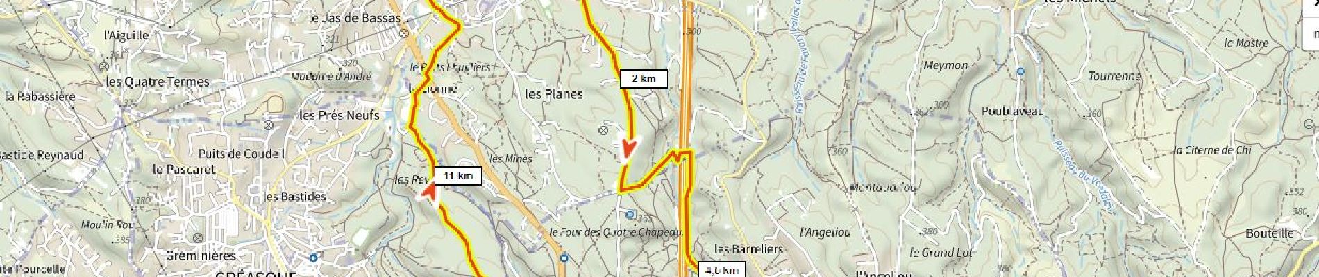
Les Planes, écopont, Belcodène, la Galère, forêt de Gréasque

ericberlin
User

Length
13.4 km

Max alt
397 m

Uphill gradient
258 m
Km-Effort
16.8 km

Min alt
255 m

Downhill gradient
258 m
Boucle
Yes
Creation date :
2022-02-02 11:07:23.743
Updated on :
2023-06-14 13:51:51.897
3h49
Difficulty : Difficult
1h10
Difficulty : Easy

FREE GPS app for hiking
 SityTrail
IGN / Geographical institutes
SityTrail Plus
The world is yours!
About
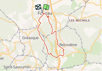
Trail Walking of 13.4 km to be discovered at Provence-Alpes-Côte d'Azur, Bouches-du-Rhône, Fuveau. This trail is proposed by ericberlin.
Photos


Positioning
Country:
France
Region :
Provence-Alpes-Côte d'Azur
Department/Province :
Bouches-du-Rhône
Municipality :
Fuveau
Location:
Unknown
Start:(Dec)
Start:(UTM)
706984 ; 4814357 (31T) N.
Comments