


NewTrack

ARVIEU
User

Length
125 km

Max alt
2238 m

Uphill gradient
9007 m
Km-Effort
244 km

Min alt
537 m

Downhill gradient
8770 m
Boucle
No
Creation date :
2022-02-06 06:48:59.921
Updated on :
2022-02-06 06:55:21.207
55h33
Difficulty : Very difficult

FREE GPS app for hiking
 SityTrail
IGN / Geographical institutes
SityTrail Plus
The world is yours!
About
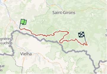
Trail Walking of 125 km to be discovered at Occitania, Haute-Garonne, Fos. This trail is proposed by ARVIEU.
Photos

Positioning
Country:
France
Region :
Occitania
Department/Province :
Haute-Garonne
Municipality :
Fos
Location:
Unknown
Start:(Dec)
Start:(UTM)
314964 ; 4749289 (31T) N.
Comments