


Cascade de l Enversin

Tof Tof
User

Length
6.1 km

Max alt
623 m

Uphill gradient
350 m
Km-Effort
10.8 km

Min alt
354 m

Downhill gradient
372 m
Boucle
No
Creation date :
2022-02-06 13:15:45.987
Updated on :
2022-02-06 16:01:04.815
2h15
Difficulty : Easy

FREE GPS app for hiking
 SityTrail
IGN / Geographical institutes
SityTrail Plus
The world is yours!
About
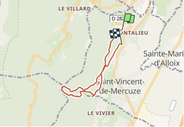
Trail Walking of 6.1 km to be discovered at Auvergne-Rhône-Alpes, Isère, Saint-Vincent-de-Mercuze. This trail is proposed by Tof Tof.
Positioning
Country:
France
Region :
Auvergne-Rhône-Alpes
Department/Province :
Isère
Municipality :
Saint-Vincent-de-Mercuze
Location:
Unknown
Start:(Dec)
Start:(UTM)
731079 ; 5030118 (31T) N.
Comments