Loop of Froyennes
Commissariat général au Tourisme
Randonnées du CGT GUIDE+

Length
26 km

Max alt
77 m

Uphill gradient
156 m

Km-Effort
28 km

Min alt
14 m

Downhill gradient
157 m
Boucle
Yes
Creation date :
2022-02-08 11:37:03.418
Updated on :
2022-02-21 10:18:31.515
--
Difficulty : Unknown

FREE GPS app for hiking
About
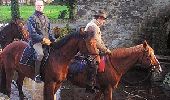
Trail Equestrian of 26 km to be discovered at Wallonia, Hainaut, Tournai. This trail is proposed by Commissariat général au Tourisme.
Description
Trail created by Wallonie Picarde (Antenne Tournai) .
This circuit is only available in French and in Dutch. Please feel free to download the FR map card.
Positioning
Country:
Belgium
Region :
Wallonia
Department/Province :
Hainaut
Municipality :
Tournai
Location:
Unknown
Start:(Dec)
Start:(UTM)
521534 ; 5608440 (31U) N.
Comments


 SityTrail


