Trail On foot Ham-sur-Heure-Nalinnes - Promenade de Jamioulx - Photo

Randonnées du CGT GUIDE+

© OpenStreetMap contributors
Length
Length
5 km
Max alt
Max alt
211 m
Uphill gradient
Uphill gradient
117 m
Km-Effort
Km-Effort  
6.5 km
Min alt
Min alt
119 m
Downhill gradient
Downhill gradient
117 m
Boucle
Boucle
Yes
Creation date :
2022-02-08 11:37:28.495
Updated on :
2022-02-21 10:18:58.183

(1 Reviews)

On foot
On foot
1h29
Difficulty : Easy

Scan this QR Code to open this trail in the SityTrail application

FREE GPS app for hiking

Logo SityTrail SityTrail

IGN / Geographical institutes

Download SityTrail from the App Store Download SityTrail from Google Play

Logo SityTrail SityTrail World

The world is yours!

Download SityTrail from the App Store Download SityTrail from Google Play Download SityTrail on Huawei AppGallery

About

Trail On foot of 5 km to be discovered at Wallonia, Hainaut, Ham-sur-Heure-Nalinnes. This trail is proposed by Commissariat général au Tourisme.

Description

Trail created by Pays des Lacs.


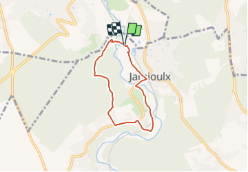
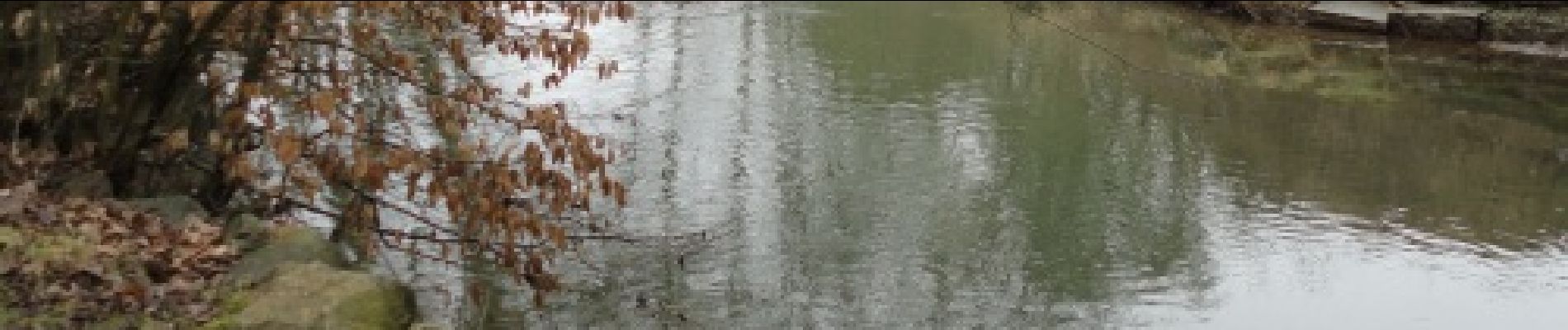
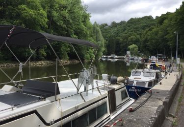
This walk, which starts from the centre of Jamioulx, begins by following the railway tracks towards the Hébert route, which is also known as ‘the Jamioulx wasteland’, to escape along small, wooded paths. Cross a small bridge that spans the Eau d’Heure, which flows further into the Sambre. After passing through the Bois de Marbaix forest, the route runs through orchards, fields and meadows with cattle and offers a beautiful panoramic view of the Eau d’Heure valley. The route also passes a site of biological interest known for its abundant flowers, insects, amphibians, birds and small mammals, such as rabbits and foxes.


Elevation profile

Photos

Positioning

Country:
Belgium
Region :
Wallonia
Department/Province :
Hainaut
Municipality :
Ham-sur-Heure-Nalinnes
Location:
Unknown
Start:(UTM)
600044 ; 5579374 (31U) N.

Comments

Please log in to post a review or rate the element


Trails nearby

Trail Walking Gerpinnes - La promenade des Lacs de Loverval - Photo
Walking
GUIDE
Desrumaux

Walking

Easy
(7)
Gerpinnes, Wallonia, Hainaut, Belgium
8.5 km | 10.6 km-effort
2h 10min
Yes
Trail Walking Ham-sur-Heure-Nalinnes - Promenade dans le Bois Jacques - Photo
Walking
GUIDE
Desrumaux

Walking

Very easy
(8)
Ham-sur-Heure-Nalinnes, Wallonia, Hainaut, Belgium
3.5 km | 4.7 km-effort
1h 0min
Yes
Trail Walking Montigny-le-Tilleul - A la découverte des sentes et venelles de Montigny-le-Tilleul - Photo
Walking
GUIDE
Desrumaux

Walking

Easy
(6)
Montigny-le-Tilleul, Wallonia, Hainaut, Belgium
7.8 km | 9.9 km-effort
2h 0min
Yes
Trail Walking Montigny-le-Tilleul - Balade en Val de Sambre - De Landelies à l'Abbaye d'Aulne  - Photo
Walking
GUIDE
Desrumaux

Walking

Very easy
(1)
Montigny-le-Tilleul, Wallonia, Hainaut, Belgium
6.6 km | 8 km-effort
1h 49min
Yes
Trail Walking Ham-sur-Heure-Nalinnes - Balade printanière à Ham-sur-Heure - Photo
Walking
GUIDE
Desrumaux

Walking

Easy
(1)
Ham-sur-Heure-Nalinnes, Wallonia, Hainaut, Belgium
11.5 km | 14.5 km-effort
3h 7min
Yes
Trail Walking Charleroi - RB-HA-06 - Le poumon vert du Pays Noir - Photo
Walking
PRO

Walking

Very difficult
(4)
Charleroi, Wallonia, Hainaut, Belgium
21 km | 26 km-effort
5h 58min
Yes
Trail Walking Ham-sur-Heure-Nalinnes -  Balade en forêt à Ham-sur-Heure - Photo
Walking
GUIDE
Desrumaux

Walking

Easy
(2)
Ham-sur-Heure-Nalinnes, Wallonia, Hainaut, Belgium
5.7 km | 7.1 km-effort
1h 30min
Yes
Trail Walking Ham-sur-Heure-Nalinnes - Balade en forêt à Ham-sur-Heure - Photo
Walking
GUIDE
Desrumaux

Walking

Medium
(1)
Ham-sur-Heure-Nalinnes, Wallonia, Hainaut, Belgium
9 km | 11 km-effort
2h 23min
Yes
Trail Walking Montigny-le-Tilleul - BE-Montigny-le-Tilleul - Landelies - Aulne - 2 - Photo
Walking
MicDul

Walking

Very easy
(1)
Montigny-le-Tilleul, Wallonia, Hainaut, Belgium
7.1 km | 9.6 km-effort
2h 4min
Yes


Close
My subscriptions