Trail Walking Stavelot - Chemin des Sources |stage 2 FRANCORCHAMPS - COO - STAVELOT - Photo

Chemin des Sources |stage 2 FRANCORCHAMPS - COO - STAVELOT

Découvrez votre nature PRO

© OpenStreetMap contributors
Length
Length
24 km
Max alt
Max alt
510 m
Uphill gradient
Uphill gradient
743 m
Km-Effort
Km-Effort  
35 km
Min alt
Min alt
233 m
Downhill gradient
Downhill gradient
909 m
Boucle
Boucle
No
Creation date :
2022-02-08 13:37:15.232
Updated on :
2024-01-12 14:53:32.734

(1 Reviews)

Walking
Walking
7h53
Difficulty : Very difficult

Scan this QR Code to open this trail in the SityTrail application

FREE GPS app for hiking

Logo SityTrail SityTrail

IGN / Geographical institutes

Download SityTrail from the App Store Download SityTrail from Google Play

Logo SityTrail SityTrail World

The world is yours!

Download SityTrail from the App Store Download SityTrail from Google Play Download SityTrail on Huawei AppGallery

About

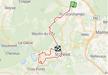
Trail Walking of 24 km to be discovered at Wallonia, Liège, Stavelot. This trail is proposed by Chemin des Sources.

Description

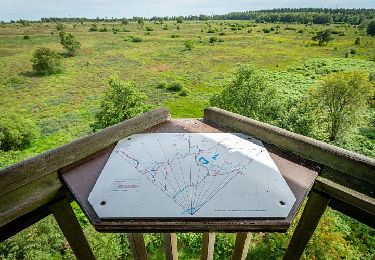
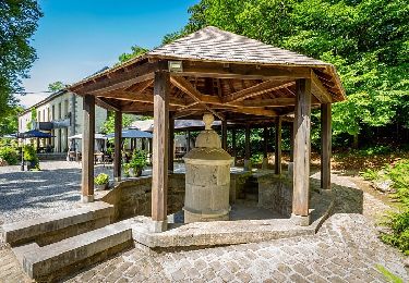
Start at the Roannay stream

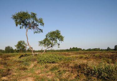
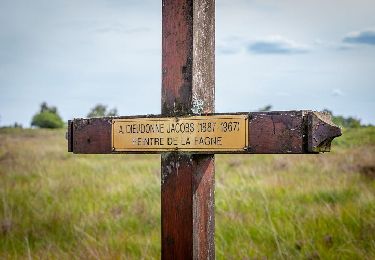
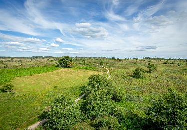
This route passes through typical Ardennes hamlets nestled in the depths of magnificent valleys where the meandering Warche and Amblève rivers and their magnificent viewpoints will remind you of the Vosges region.

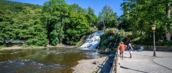
After a more sportive descent, hikers can discover the Coo waterfall, the lower lake of the hydroelectric power station and the Plopsa Coo amusement park.

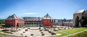
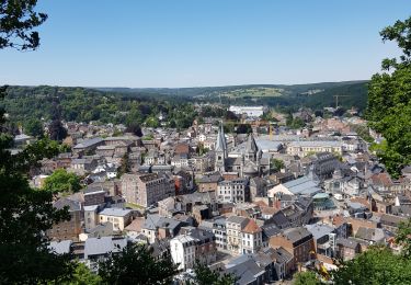
The walk ends with a visit to the historical centre of Stavelot and its prestigious Abbey.

Elevation profile

Photos

Points of interest

Point of interest Stavelot - Devil's Rock - Photo
Chemin des Sources
STAVELOT 
Point of interest Stavelot - Coo waterfall  - Photo
Chemin des Sources
STAVELOT 
Point of interest Stavelot - Stavelot Abbey - Photo
Chemin des Sources
STAVELOT 
Point of interest Stavelot - FINISH - Photo
Supersylvain
STAVELOT 

Positioning

Country:
Belgium
Region :
Wallonia
Department/Province :
Liège
Municipality :
Stavelot
Location:
Unknown
Start:(UTM)
709160 ; 5593651 (31U) N.

Comments

Please log in to post a review or rate the element


Superbe 2ème étape, parcours boisé. 24 km annoncés mais 27 km en réalité.


Trails nearby

Trail Walking Spa - Berinzenne. Natura 2000, des sites qui valent le détour. Lg 14. - Photo
Walking
GUIDE+

Walking

Medium
(12)
Spa, Wallonia, Liège, Belgium
9 km | 12 km-effort
2h 34min
Yes
Trail Walking Spa - Malchamps. Natura 2000, des sites qui valent le détour. Lg1 - Photo
Walking
GUIDE+

Walking

Easy
(12)
Spa, Wallonia, Liège, Belgium
4.1 km | 4.7 km-effort
1h 3min
Yes
Trail Walking Spa - Lac de Warfaaz  - Balmoral  - Photo
Walking
GUIDE
mumu.larandonneuse

Walking

Medium
(4)
Spa, Wallonia, Liège, Belgium
10.5 km | 13.8 km-effort
3h 8min
Yes
Trail Walking Spa - SPA 17 - La Fagne de Malchamps par la Vecquée 🟦 - Photo
Walking
PRO

Walking

Medium
(1)
Spa, Wallonia, Liège, Belgium
9.2 km | 10.8 km-effort
2h 27min
Yes
Trail On foot Spa - SPA 14 - Promenade Royale 🟦 - Photo
On foot
PRO

On foot

Easy
(1)
Spa, Wallonia, Liège, Belgium
9.5 km | 11.7 km-effort
2h 40min
No
Trail On foot Spa - SPA 13 - Spa Hydrotherapy 🟩 - Photo
On foot
PRO

On foot

Easy
(1)
Spa, Wallonia, Liège, Belgium
12.4 km | 16 km-effort
3h 38min
Yes
Trail On foot Spa - SPA 12 - Spa Waters 🟥 - Photo
On foot
PRO

On foot

Easy
(2)
Spa, Wallonia, Liège, Belgium
9.5 km | 12.6 km-effort
2h 51min
Yes
Trail On foot Spa - SPA 11 - Petite Boucle de Malchamps 🟨 - Photo
On foot
PRO

On foot

Easy
(1)
Spa, Wallonia, Liège, Belgium
5.1 km | 6.4 km-effort
1h 27min
Yes
Trail Walking Stavelot - 20211213 - Hockay 5.4 Km - Photo
Walking
GUIDE
pierreh01

Walking

Medium
(3)
Stavelot, Wallonia, Liège, Belgium
5.1 km | 6.6 km-effort
1h 34min
Yes


Close
My subscriptions