


hermeray Orphin

topophil
User

Length
11.9 km

Max alt
177 m

Uphill gradient
135 m
Km-Effort
13.7 km

Min alt
130 m

Downhill gradient
132 m
Boucle
Yes
Creation date :
2022-02-09 08:16:36.886
Updated on :
2022-02-09 11:12:18.849
2h55
Difficulty : Difficult

FREE GPS app for hiking
 SityTrail
IGN / Geographical institutes
SityTrail Plus
The world is yours!
About
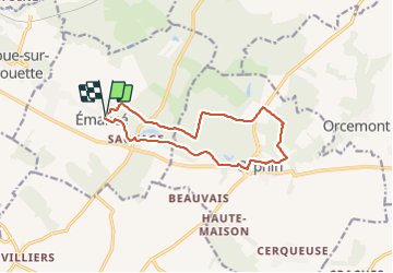
Trail Walking of 11.9 km to be discovered at Ile-de-France, Yvelines, Émancé. This trail is proposed by topophil.
Positioning
Country:
France
Region :
Ile-de-France
Department/Province :
Yvelines
Municipality :
Émancé
Location:
Unknown
Start:(Dec)
Start:(UTM)
406486 ; 5382625 (31U) N.
Comments