Trail Walking Barbonne-Fayel - dans le vignoble Champenois autour de BARBONNE-FAYEL - Photo

dans le vignoble Champenois autour de BARBONNE-FAYEL

© OpenStreetMap contributors
Length
Length
11.7 km
Max alt
Max alt
188 m
Uphill gradient
Uphill gradient
169 m
Km-Effort
Km-Effort  
14 km
Min alt
Min alt
97 m
Downhill gradient
Downhill gradient
167 m
Boucle
Boucle
Yes
Creation date :
2022-02-09 10:41:01.608
Updated on :
2022-02-11 10:19:08.039

(0 Reviews)

Walking
Walking
4h27
Difficulty : Easy

Scan this QR Code to open this trail in the SityTrail application

FREE GPS app for hiking

Logo SityTrail SityTrail

IGN / Geographical institutes

Download SityTrail from the App Store Download SityTrail from Google Play

Logo SityTrail SityTrail World

The world is yours!

Download SityTrail from the App Store Download SityTrail from Google Play Download SityTrail on Huawei AppGallery

About

Trail Walking of 11.7 km to be discovered at Grand Est, Marne, Barbonne-Fayel. This trail is proposed by jeannine grandjean.

Description

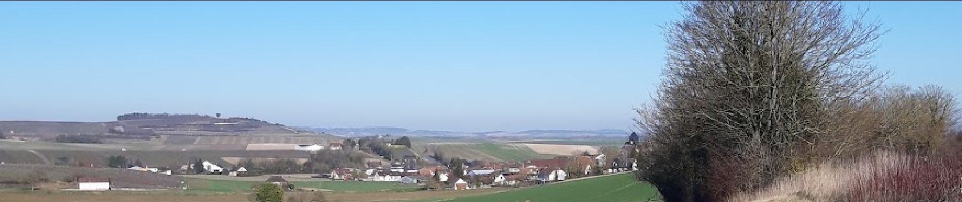
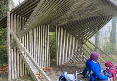
très agréable rando avec de nombreuses vues panoramiques, à la lisière des bois, à travers les vignes. Arrêt pique-nique très sympathique dans une suoerbe "loge de vignes" (construite en 2019) et dominant le village. Les promenades ombragées qui entourent le village sont très reposantes.

Elevation profile

Photos

Positioning

Country:
France
Region :
Grand Est
Department/Province :
Marne
Municipality :
Barbonne-Fayel
Location:
Unknown
Start:(UTM)
551289 ; 5389657 (31U) N.

Trails nearby

Trail Walking Barbonne-Fayel - Découverte des bois de Barbonne - Photo
Walking
NANE51

Walking

Barbonne-Fayel, Grand Est, Marne, France
13 km | 16.2 km-effort
3h 29min
Yes
Trail Walking Saint-Quentin-le-Verger - Boucle Dt Quentin le Verger  - Photo
Walking
NANE51

Walking

Very easy
Saint-Quentin-le-Verger, Grand Est, Marne, France
12.7 km | 14.3 km-effort
2h 42min
Yes
Trail Walking La Celle-sous-Chantemerle - Boucle la celle vers Chantemerle Bethon - Photo
Walking
NANE51

Walking

La Celle-sous-Chantemerle, Grand Est, Marne, France
12.4 km | 15.2 km-effort
2h 59min
Yes
Trail On foot Le Meix-Saint-Epoing - Traconne et forêt communale de Saudoy - Photo
On foot
Alain Picard

On foot

Medium
Le Meix-Saint-Epoing, Grand Est, Marne, France
10.3 km | 11.8 km-effort
Unknown
Yes
Trail On foot La Forestière - RD 8km Traconne - Photo
On foot
Alain Picard

On foot

Easy
La Forestière, Grand Est, Marne, France
8 km | 8.9 km-effort
2h 30min
Yes
Trail On foot La Forestière - rando de nuit en Traconne - Photo
On foot
Alain Picard

On foot

Easy
La Forestière, Grand Est, Marne, France
9.8 km | 10.9 km-effort
2h 30min
Yes
Trail On foot La Forestière - rando de nuit en Traconne - Photo
On foot
Alain Picard

On foot

Easy
La Forestière, Grand Est, Marne, France
9.8 km | 10.9 km-effort
2h 30min
Yes
Trail On foot Barbonne-Fayel - Barbonne-Fayel , - Photo
On foot
Alain Picard

On foot

Easy
Barbonne-Fayel, Grand Est, Marne, France
9 km | 11.3 km-effort
2h 30min
Yes
Trail On foot Barbonne-Fayel - RD Barbonne Lancourt - Photo
On foot
Alain Picard

On foot

Very easy
Barbonne-Fayel, Grand Est, Marne, France
7.2 km | 9 km-effort
Unknown
Yes


Close
My subscriptions