La Salce/Pisse Vin/ les allemands

andre06130
User
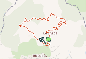

Length
5.1 km

Max alt
1557 m

Uphill gradient
236 m
Km-Effort
8.2 km

Min alt
1316 m

Downhill gradient
233 m
Boucle
Yes
Creation date :
2022-02-09 15:29:37.751
Updated on :
2022-02-10 15:59:24.654
1h45
Difficulty : Medium

FREE GPS app for hiking
 SityTrail
IGN / Geographical institutes
SityTrail Plus
The world is yours!
About
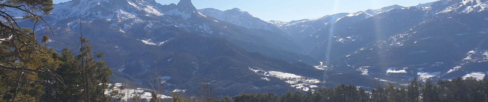
Trail Walking of 5.1 km to be discovered at Provence-Alpes-Côte d'Azur, Alpes-de-Haute-Provence, Barcelonnette. This trail is proposed by andre06130.
Photos

Positioning
Country:
France
Region :
Provence-Alpes-Côte d'Azur
Department/Province :
Alpes-de-Haute-Provence
Municipality :
Barcelonnette
Location:
Unknown
Start:(Dec)
Start:(UTM)
312863 ; 4918284 (32T) N.
Comments