


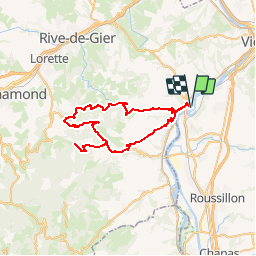
Balade 2 Condrieu

bosses21
User

Length
55 km

Max alt
950 m

Uphill gradient
1311 m
Km-Effort
73 km

Min alt
142 m

Downhill gradient
1311 m
Boucle
Yes
Creation date :
2014-12-10 00:00:00.0
Updated on :
2014-12-10 00:00:00.0
4h07
Difficulty : Difficult

FREE GPS app for hiking
 SityTrail
IGN / Geographical institutes
SityTrail Plus
The world is yours!
About
Trail Cycle of 55 km to be discovered at Auvergne-Rhône-Alpes, Rhône, Condrieu. This trail is proposed by bosses21.
Description
Col de Pavezin - 651m
Col de la croix du Mazet - 656m
Croix de Montvieux - 812m
Collet de Doizieux - 946m


Positioning
Country:
France
Region :
Auvergne-Rhône-Alpes
Department/Province :
Rhône
Municipality :
Condrieu
Location:
Unknown
Start:(Dec)
Start:(UTM)
638895 ; 5035677 (31T) N.
Comments